Verify Your Property Documents
Don't Overlook

We invest lakhs sometimes crores into property, yet hesitate to spend a little time or effort on verifying the documents. That one small oversight can cost far more than the investment itself.
Document verification isn’t just a formality, it’s your strongest protection against legal troubles, financial loss, and uncertainty. A few careful checks today can secure your investment, your peace of mind, and your future.

Call us to get the complete list of documents and permissions you need to verify before buying various property types, such as farm lands, farm plots, residential plots, villas, flats, independent houses, and commercial properties. We’re here to help you make safe and informed real estate decisions.
Encumbrance Certificate (EC)
An Encumbrance Certificate (EC) is a legal document that verifies a property’s ownership status and confirms that it’s free of any legal or financial encumbrances. It’s also known as a Property Certificate.
Key Features of EC:
- Purpose:
- Confirms the property is free from encumbrances (e.g., loans, mortgages, legal disputes) or discloses any existing liabilities.
- Ensures clear title, protecting buyers from fraud, hidden claims, or financial burdens.
- Facilitates property transactions, loans, and legal processes by providing a transaction history.
- Details Included:
- Property Description: Survey number, location, boundaries, and extent.
- Registered Transactions: Sales, mortgages, gifts, leases, partitions, or releases recorded in the Sub-Registrar’s office.
- Parties Involved: Names of buyers, sellers, or lienholders.
- Time Period: Transactions for the requested period (e.g., past 12 years or more).
- Nil EC: Issued if no encumbrances are found, confirming a clear title.
- Legal Framework:
- Governed by the Registration Act, 1908, and managed by the Registration and Stamps Department of Telangana.
Integrated with the Telangana Bhu Bharati (Record of Rights in Land) Act, 2024, for seamless access via the Bhu Bharati Portal.
Agriculture EC
The Encumbrance Certificate (EC) for agricultural land in Telangana is a vital document that ensures transparency, legal clarity, and financial security in land transactions, particularly in the context of the state’s significant agricultural economy and growing real estate sector regulated by the Telangana Real Estate Regulatory Authority (TGRERA)
Importance of EC for Agricultural Land:
- Verification of Clear Title:
- An EC confirms whether the agricultural land is free from legal or financial liabilities, such as mortgages, loans, liens, or disputes. This is critical in Telangana, where 5% of the state’s 114.84 lakh hectares is under cultivation, and fragmented land holdings (average 1.12 hectares) often lead to ownership disputes.
- Ensures buyers or investors acquire land with undisputed ownership, preventing future legal battles.
- Facilitates Property Transactions:
- Mandatory for buying, selling, or transferring agricultural land. The EC lists all registered transactions (e.g., sales, leases) over a specified period, ensuring transparency.
- Essential for converting agricultural land to non-agricultural use, especially in urbanizing areas like Hyderabad (e.g., Gachibowli, Nanakramguda), where agricultural land is repurposed for real estate projects under TGRERA oversight.
- Loan and Financial Security:
- Banks and financial institutions require an EC (typically covering 10–15 years) to approve loans against agricultural land, as it verifies the land is unencumbered and can be used as collateral.
- Protects farmers seeking credit for agricultural inputs (seeds, fertilizers) or infrastructure (e.g., wells, as 22.07 lakh hectares are irrigated by wells/tube wells).
- TGRERA Compliance for Real Estate:
- For agricultural land used in real estate projects (e.g., plotted developments), TGRERA mandates an EC to confirm clear title before project registration. Projects over 500 square meters or with more than 8 units must be registered with TGRERA.
- The EC is uploaded to telangana.gov.in, ensuring buyers can verify the land’s status. Non-compliance, like promoting projects without a valid EC, incurs penalties.
- Identification of Prohibited Lands:
- Recent updates allow ECs to indicate if agricultural land is restricted from non-agricultural use due to zoning or government regulations (e.g., in Chevella, Moinabad). This is crucial for real estate developers to avoid investing in land ineligible for development.
- The Bhu Bharati Portal (IM3: Prohibited Lands) complements the EC by flagging such restrictions, protecting investors and farmers.
- Prevents Fraud and Disputes:
- By detailing all registered transactions (via survey number, village, mandal), the EC prevents fraudulent sales or double registrations, common in Telangana due to high land value near urban centers.
- Helps resolve inheritance or partition disputes, prevalent in agricultural communities with small, fragmented holdings.
- Supports Agricultural Economy:
- Telangana’s agriculture, driven by crops like rice, cotton, and maize, relies on secure land ownership for investment in modern farming techniques. An EC ensures farmers can confidently lease, sell, or mortgage land to fund improvements, aligning with the Department of Agriculture’s 6% growth target.
- Facilitates government schemes (e.g., subsidies, irrigation projects) by verifying land ownership.
- Market Value and Stamp Duty Assessment: The EC, combined with the Market Value Search on registration.telangana.gov.in, helps determine the fair market value of agricultural land for stamp duty calculations during transactions, ensuring compliance with state regulations.
TG-RERA
The Telangana Real Estate Regulatory Authority (TGRERA or TS RERA) was established under the Real Estate (Regulation and Development) Act, 2016, with the Telangana State Real Estate (Regulation and Development) Rules, 2017, notified on July 31, 2017, to regulate and promote the real estate sector in Telangana. It aims to ensure transparency, protect homebuyers, and foster accountability among developers and agents.
Key Objectives of RERA:
- Transparency: Create an efficient and transparent process for buying and selling real estate.
- Regulation and Promotion: Oversee the real estate sector to ensure fair practices and promote growth.
- Consumer Protection: Safeguard homebuyers’ interests and ensure timely project delivery.
- Dispute Resolution: Establish a fast-track mechanism through an Appellate Tribunal for resolving grievances.
- Public Access to Information: Maintain an online platform for project and agent registration details.
Key Features and Regulations:
- Mandatory Registration:
- All real estate projects approved on or after January 1, 2017, with a land area exceeding 500 square meters or containing more than 8 apartments must be registered with TGRERA. This applies to new and ongoing projects.
- Exceptions include projects where the land area is less than 500 square meters, fewer than 8 apartments, or those involving only renovation/repair without marketing or new allotments.
- Real estate agents facilitating sales or purchases in registered projects must also register with TGRERA.
- Quarterly Progress Reports (QPRs):
- Promoters must upload quarterly reports by 15th April, 15th July, 15th October, and 15th January (within 15 days of each quarter’s end) as per Section 11 (1) (b) to (f) of the RERA Act. Failure to comply may lead to penalties.
- A circular dated March 18, 2025, emphasized compliance with QPR submissions.
- Project Promotion:
- Developers cannot advertise, market, or sell projects until they are registered with TGRERA. This includes any phase of a project.
- For example, in May 2025, TGRERA fined Sanali Housing Projects ₹4.2 lakh for promoting Sanali Pinnacle in Hyderabad without registration and barred them from marketing until compliance.
- Timelines for Legal Obligations:
- Society Formation: Promoters must form a legal entity (e.g., cooperative society) within 2 months of 60% of buyers taking possession and paying full consideration.
- Conveyance Deed: A registered conveyance deed must be executed in favor of the allottee within 3 months of the issuance of the Occupancy Certificate.
- Complaint Resolution: The Appellate Tribunal aims to resolve complaints within 60 days, with reasons recorded if delays occur.
- Penalties for Non-Compliance:
- Unregistered projects face penalties up to 10% of the estimated project cost.
- Unregistered agents facilitating sales may incur a penalty of ₹10,000 per day or up to 5% of the project cost.
- TGRERA has taken action against violations, such as pulling up a Hyderabad builder for unilaterally canceling a sale agreement in May 2025.
- Registration Fees:
- Real Estate Agents: ₹10,000 for individuals, ₹50,000 for entities, with a validity of 5 years.
- Projects: For mixed projects, ₹10 per square meter for construction areas under 1,000 square meters, and ₹15 per square meter for areas above 1,000 square meters.
HMDA
The Hyderabad Metropolitan Development Authority (HMDA) is a key urban planning and development agency in Telangana, succeeding the Hyderabad Urban Development Authority (HUDA). It oversees the planned development of the Hyderabad Metropolitan Region (HMR), spanning 7,257 square kilometers across seven districts (Hyderabad, Medchal-Malkajgiri, Rangareddy, Bhuvanagiri, Sangareddy, Medak, and Siddipet), covering 70 mandals and 1,032 villages, including the Greater Hyderabad Municipal Corporation (GHMC). HMDA plays a critical role in real estate by regulating land use, approving layouts, and ensuring infrastructure development, closely interacting with the Telangana Real Estate Regulatory Authority (TGRERA) to ensure compliance and transparency.
HMDA’s Role in Real Estate in Telangana:
- Urban Planning and Master Plan 2031:
- HMDA’s Master Plan 2031 provides a blueprint for sustainable urban development, zoning land for residential (R1: high-density, R2: low/medium-density), commercial, industrial, and recreational use. It covers districts like Bibinagar, Bhuvanagiri, Chevella, and Ghatkesar, ensuring organized growth.
- The plan emphasizes efficient land use, green infrastructure, and transportation (e.g., radial/ring roads, metro rail expansion) to reduce congestion and enhance connectivity, directly impacting real estate project viability.
- Recent updates include a 2 km buffer zone outside the Regional Ring Road (RRR) designated as the RRR Growth Corridor, expanding HMDA’s purview to accommodate future real estate development.
- Layout and Building Approvals:
- HMDA approves layouts, building permissions, and occupancy certificates for real estate projects within its jurisdiction, except for Change of Land Use (CLU), which is processed separately. Since April 24, 2024, these approvals are exclusively processed via the Telangana State Building Permissions and Self Certification System (TG-bPASS) at telangana.gov.in, replacing the earlier Development Permission Management System (DPMS) for Gram Panchayat areas under HMDA.
- HMDA-approved plots ensure infrastructure like water supply, drainage, and electricity, making them safer investments compared to Gram Panchayat (GP) plots, which often lack such guarantees and require conversion fees (5% of circle rate) for non-agricultural use.
- The TS-bPASS Act (2020) streamlines approvals, ensuring transparency and time-bound processing, with deemed approvals revocable within 21 days if misrepresented. This has accelerated real estate development in Hyderabad.
DTCP
The Directorate of Town and Country Planning (DTCP) in Telangana is a government body responsible for regulating and planning urban and rural development outside the jurisdiction of the Hyderabad Metropolitan Development Authority (HMDA) and other urban development authorities. DTCP approval is essential for real estate projects, including open plot layouts, buildings, and industrial developments, to ensure compliance with zoning, safety, and infrastructure standards as per the Telangana Town Planning Act, 1920, Telangana Municipalities Act, 2019, TS-bPASS Act, 2020, and other regulations.
Terms and Conditions for DTCP Approval:
DTCP imposes strict rules to ensure safe, planned, and sustainable development, particularly for open plot layouts in Telangana. These align with the Telangana Panchayat Raj Act, 1994, for rural areas and other local body acts. Key terms and conditions include:
- Layout Approval:
- All layouts must obtain DTCP approval before development begins. Unauthorized layouts are illegal and face penalties or demolition.
- Layout plans must comply with the Master Plan or Indicative Land Use Plan for the area.
- Road Widths:
- Main Roads: Minimum 12 meters
- Internal Roads: Minimum 9 meters
- Roads must align with the master plan’s road network and land use plan.
- Open Spaces and Greenery:
- At least 10% of the layout area must be reserved for open spaces (parks, playgrounds).
- A minimum of 20% greenery (trees, shrubs) is required to promote environmental sustainability.
- Infrastructure Requirements:
- Water Supply: Approved system for potable water.
- Sewerage System: Proper sewage disposal, approved by relevant authorities.
- Drainage System: Designed to prevent waterlogging, especially during monsoons.
- Electrical Supply: Street lighting and power connections, approved by the Telangana Transmission Corporation.
- Fire Safety: Fire hydrants, extinguishers, and alarms for larger layouts.
- Plot Mortgage:
- Developers must mortgage 10–25% of the plotted area (varies by project) to DTCP or the local authority as a guarantee for completing infrastructure works.
- The mortgaged area is released upon final approval after infrastructure verification.
- TGRERA Compliance:
- Layouts exceeding 500 square meters or 8 units must be registered with TGRERA (rera.telangana.gov.in).
- DTCP approval and an EC are prerequisites for TGRERA registration, with layout plans and approval details uploaded for public access.
- Non-compliance risks penalties up to 10% of the project cost, as seen in cases like Sanali Housing Projects (May 2025).
- Development Timeline:
- Infrastructure works must be completed within 12–18 months of tentative approval, subject to DTCP inspection.
- Delays may lead to approval revocation or additional penalties.
- Safety and Zoning Compliance:
- Layouts must adhere to safety standards (e.g., fire safety, structural stability).
- Zoning must match the master plan (e.g., residential, commercial, or industrial use).
- Agricultural land requires NALA conversion, verified via Dharani, to ensure non-agricultural use eligibility.
- Public Disclosure:
- Approved layout details, including the LP Number, must be publicly accessible via the DTCP website or local authority records.
- Developers must disclose DTCP approval and TGRERA registration to buyers to ensure transparency.
- Penalties for Non-Compliance:
- Unauthorized development or sales without DTCP approval may lead to fines, layout suspension, or legal action.
- Non-compliance with infrastructure or zoning rules can result in approval cancellation or plot confiscation (though ownership remains unaffected unless disputed).
Bhu Bharati
The Bhu Bharati Portal is a digital platform launched by the Telangana State Government on April 14, 2025, to modernize land record management and enhance transparency in land-related services. It replaced the Dharani Portal. This portal is governed by the Telangana Bhu Bharati (Record of Rights in Land) Act, 2024.
Key Features of The Bhu Bharati Portal:
- Simplified Interface: Bhu Bharati has only 6 modules, making it easier to navigate, even for those with limited digital literacy.
- Free Access: Offering free access to land records.
- Real-Time Updates: Provides instant SMS notifications on application status, ensuring landowners stay informed.
- Bhudhar Number: Assigns a unique ID to each land parcel (similar to Aadhaar), enabling precise identification and tracking.
- Publicly Accessible Records: Promotes transparency by making land ownership details, survey numbers, and land status openly available, reducing fraud and hidden transactions.
- Comprehensive Services:
- Access to land records (RoR-1B, Pahani details).
- Online applications for encumbrance certificates, mutations, and property registrations.
- Appeals, revisions, and conversion of agricultural to non-agricultural land.
- Grievance redressal with a structured appeal mechanism (escalation to Tahsildar, RDO, or District Collector based on land value).
- Digital Mapping and Surveys: Uses drone technology for accurate land mapping and introduces the Bhudaar System for permanent land surveys, ensuring precise demarcation.
- Legal Support: Offers free legal aid to poor landowners and recognizes pre-2014 Sadabainama transactions for legal validity.
- Historical Pahani Records: Revives and modifies Pahani records with 11 essential columns for detailed land information (ownership, survey numbers, land type)
FTL & Buffer Zone
In Telangana, FTL (Full Tank Level) and Buffer Zones are critical concepts related to land use and property development, particularly near water bodies like lakes, tanks, canals, and rivers. They are regulated to protect water bodies, prevent encroachments, and ensure environmental sustainability. Verifying these is essential before buying property to avoid legal issues, financial losses, or demolition by authorities like HYDRA (Hyderabad Disaster Response and Assets Protection Agency). Below is a concise explanation tailored to Telangana’s context:
Full Tank Level (FTL):
- Definition: FTL is the maximum water level a water body (e.g., lake, tank, pond, or nala) can hold under normal conditions without overflowing. It defines the boundary up to which water naturally spreads, as certified by the Irrigation and Command Area Development (CAD) Department and Revenue Department.
- Key Points:
- No Construction Allowed: Any structure within the FTL boundary is illegal, non-registerable, and non-transferable under Telangana’s land laws. Such properties face demolition risks, as enforced by HYDRA.
- Purpose: Protects water bodies from encroachment, preserves storage capacity, and mitigates flood risks.
- Identification: FTL boundaries are marked in land records, survey maps, and platforms like the Bhu Bharati Portal or HMDA Lakes Portal.
- Example: If a lake’s FTL is set at 100 acres, any land within that boundary is restricted for development, even if it appears dry during non-monsoon seasons.
Buffer Zone:
- Definition: A buffer zone is a restricted area surrounding the FTL boundary of a water body, where construction and development are either prohibited or strictly regulated to safeguard the water body’s ecosystem and prevent pollution or encroachment.
- Buffer Zone Widths in Telangana (as per Telangana Municipalities Act, 2019, and HMDA regulations):
- 30 meters from the FTL boundary for lakes, tanks, or kuntas with an area of 10 hectares or more (includes a 12-foot walking/cycling track).
- 9 meters from the FTL boundary for lakes, tanks, or kuntas with an area of less than 10 hectares or shikam lands (wetlands).
- 9 meters from the boundary of canals, vagus, nalas, or stormwater drains wider than 10 meters.
- 2 meters from the boundary of canals, vagus, nalas, or stormwater drains up to 10 meters wide.
- 50 meters from river boundaries within Municipal Corporation, HMDA, or Urban Development Authority limits.
- Key Points:
- Construction Restrictions: Building within buffer zones is illegal without specific approvals, and violators face demolition, fines, or legal action.
- Purpose: Maintains ecological balance, prevents flooding, and protects water quality by acting as a barrier against urban sprawl.
- Enforcement: HYDRA actively monitors and demolishes illegal structures in buffer zones, reclaiming encroached land.
How to Verify FTL and Buffer Zones:
- Bhu Bharati Portal (https://bhubharati.telangana.gov.in):
- Enter the property’s survey number, district, mandal, or village.
- Check if the land falls within FTL or buffer zones using integrated maps and records from HMDA and Revenue Departments.
- Verify encumbrance certificates and Pahani records for disputes or zoning restrictions.
- HMDA Lakes Portal (https://lakes.hmda.gov.in):
- Provides detailed FTL boundaries and buffer zone maps for lakes and tanks within HMDA limits.
- Cross-check survey numbers against lake-specific data.
- Revenue Department:
- Visit the local Tahsildar or Mandal Revenue Office to confirm FTL/buffer status in land records.
- Request Pahani records or village maps showing water body boundaries.
- Irrigation and CAD Department:
- Supplies certified FTL data and floodplain maps for tanks, lakes, and rivers.
- Physical Verification:
- Engage a licensed surveyor to confirm boundaries on-site.
- Check for water body proximity using Google Earth or Bhuvan Panchayat Portal for historical imagery.
- Legal Due Diligence:
- Hire a property lawyer to scrutinize documents like title deeds, NOCs, and building approvals for FTL/buffer compliance.
- Ensure no pending litigation or HYDRA notices.
Practical Tips for Buyers:
- Demand FTL/Buffer Maps: Ask sellers for FTL and buffer zone maps from HYDRA or HMDA before proceeding.
- Avoid Lake-View Properties: Even HMDA-approved layouts near water bodies can face retrospective restrictions.
- Check Historical Records: Properties built before FTL/buffer notifications (e.g., pre-1980s) may have limited exemptions but require legal validation.
- Monitor HYDRA Actions: Stay updated on demolition drives, as HYDRA’s jurisdiction spans 2,000 square kilometers up to Hyderabad’s Outer Ring Road.
- Cross-Check Approvals: Ensure municipal or HMDA permissions explicitly exclude FTL/buffer zones, as some approvals are issued for non-restricted portions but misused.
Master Plan
The HMDA Master Plan 2031, notified on January 30, 2013, via the Andhra Pradesh Gazette, is the active urban development plan for the Hyderabad Metropolitan Region. It was designed to provide a vision and regulations for development and construction activities to support a projected population of 184–185 lakh and a workforce of 65 lakh by 2031
Key Features:
- Coverage Area:
- Spans 5,965 sq.km (revised estimates cite 7,228–7,257 sq.km), covering:
- 55–70 mandals across seven districts: Hyderabad, Medchal-Malkajgiri, Rangareddy, Sangareddy, Yadadri-Bhuvanagiri, Medak, and Nalgonda (with partial inclusion of Mahbubnagar, Siddipet, Nagarkurnool, and Vikarabad in later expansions).
- Greater Hyderabad Municipal Corporation (GHMC), Sangareddy and Bhongir Municipalities, and 849 villages.
- Areas under the Outer Ring Road (ORR) Growth Corridor (330 sq.km), parts of the erstwhile Hyderabad Urban Development Authority (HUDA, 432 sq.km), and Hyderabad Airport Development Authority (HADA, 185 sq.km).
- Includes extended HMDA areas (5,018 sq.km) notified in 2008.
- Spans 5,965 sq.km (revised estimates cite 7,228–7,257 sq.km), covering:
- Land Use and Zoning:
- Allocates land for residential, commercial, industrial, recreational, and conservation purposes, with a focus on balanced development.
- Introduces a radial-concentric structure with new urban nodes and centers in all directions to prevent over-centralization.
- Designates a Peri-Urban Zone to control urban sprawl and preserve agricultural land.
- Specifies Mandal-wise master plans (e.g., Bibinagar, Ghatkesar, Chevella) tailored to local conditions, harmonized with the overall plan.
- Prohibits certain activities in specific zones unless exempted by the Metropolitan Commissioner.
- Infrastructure Development:
- Focuses on transport (Inner Ring Road, Outer Ring Road, radial roads, Metro Rail), water supply, sanitation, and green spaces.
- Promotes projects like the Hyderabad Metro, Hyderabad International Airport, and Hyderabad Information Technology Investment Region.
- Plans a hierarchical circulation network to meet current and future travel needs.
- Environmental Protection:
- Emphasizes blue and green infrastructure (water bodies, parks, open spaces) to protect lakes, tanks, and greenery.
- Integrates regulations for FTL (Full Tank Level) and Buffer Zones to safeguard water bodies from encroachments, critical for property verification.
- Land Development Types:
- Permits specific development schemes (e.g., layouts, group housing) only by licensed developers, unless exempted.
- Digitizes Transferable Development Rights (TDR) and processes building permissions, occupancy certificates, and layout approvals via the TG-bPASS
- Implementation:
- Enforced by HMDA, which coordinates with municipal corporations, the Telangana State Road Transport Corporation, and other agencies.
- Effective since 2013, with updates to address discrepancies in earlier plans (e.g., HUDA, HADA, Cyberabad Development Authority).
LRS
Layout Regularization Scheme (LRS) is a government initiative aimed at regularizing unapproved or illegal layouts and plots across urban and rural areas in Telangana to bring them into the fold of planned development.
Purpose:
- Legalize Unauthorized Layouts: Regularizes plots in unapproved layouts to grant legal recognition, enabling access to infrastructure and services.
- Promote Planned Development: Aligns layouts with the Hyderabad Master Plan (e.g., HMDA Master Plan 2031) to ensure compliance with zoning, land use, and environmental regulations.
- Protect Buyers: Safeguards property owners from legal disputes and ensures marketability by verifying compliance with regulations like FTL and Buffer Zones.
- Enhance Civic Amenities: Facilitates government provision of roads, water supply, drainage, and streetlights in regularized areas.
Recent Amendments (2025):
- 25% Rebate: A 25% discount on regularization and pro-rata open space charges for payments made by March 31, 2025 (extended to May 3, 2025, in some cases).
- Unregistered Plots: Allows registration of unregistered plots in layouts where ≥10% of plots were sold before August 26, 2020, even without prior LRS application.
- Fast-Track Processing: HMDA processes completed applications within 10 days. Rejected applications refund 90% of fees (10% deducted for processing).
- Water Body Scrutiny: Plots within 200m of water bodies/lakes are verified by the Irrigation and Revenue Departments to ensure no FTL/Buffer Zone violations
BRS
The Building Regularization Scheme (BRS) in Telangana is a government initiative to legalize unauthorized buildings and constructions that were built without proper approvals or deviated from sanctioned plans. It aims to bring such structures under a legal framework, promote planned urban development, ensure safety, and enhance civic amenities while generating revenue for the state. The BRS is distinct from the Layout Regularization Scheme (LRS), which focuses on regularizing unapproved plots/layouts, but both schemes work together to align properties with the Hyderabad Master Plan 2031 and regulations like FTL (Full Tank Level) and Buffer Zones
Key Features:
- Eligibility:
- Applies to buildings constructed before specific cut-off dates (e.g., October 28, 2015, for the 2015 BRS iteration).
- Covers residential, commercial, and mixed-use buildings in urban and rural areas, including Greater Hyderabad Municipal Corporation (GHMC) limits.
- Excludes buildings on prohibited lands (e.g., government, endowment, Waqf, or under legal disputes), in FTL of water bodies (lakes, tanks, nalas), or within Buffer Zones (e.g., 30m for lakes ≥10 hectares, 50m for rivers).
- Buildings must meet structural safety standards, certified by a structural engineer.
- Process:
- Applications are submitted online via the Telangana State Building Permission Approval and Self-Certification System (TG-bPASS) portal (http://tgbpass.telangana.gov.in) or through Meeseva centers.
- Requires payment of regularization fees, penalties, and submission of documents like building plans, ownership proofs, and structural safety certificates.
- Applications are scrutinized by local authorities (HMDA, GHMC, or municipal bodies) for compliance with zoning, FTL/Buffer Zones, and safety norms.
TG-bPASS
The Telangana State Building Permission Approval and Self-Certification System (TG-bPASS) is an online platform introduced by the Telangana government to streamline the process of obtaining building permissions, regularizing unauthorized constructions, and ensuring compliance with urban planning regulations. It serves as a single-window system for citizens, developers, and architects to apply for building approvals, layout permissions, and regularization under schemes like the Building Regularization Scheme (BRS) and Layout Regularization Scheme (LRS). TG-bPASS aligns with the Hyderabad Master Plan 2031, enforces FTL (Full Tank Level) and Buffer Zone regulations, and promotes transparency, efficiency, and ease of doing business in Telangana’s real estate sector.
Key Features
- Online Portal: Accessible at http://tgbpass.telangana.gov.in, allowing applications, document uploads, fee payments, and status tracking.
- Applicability:
- Covers building permissions, layout approvals, occupancy certificates, and regularization in urban and rural areas, including Greater Hyderabad Municipal Corporation (GHMC), Hyderabad Metropolitan Development Authority (HMDA), and other municipal bodies.
- Applies to residential, commercial, industrial, and mixed-use projects.
- Categories of Approvals:
- Building Permissions:
- Instant Registration: For buildings up to 10m height or 500 sq.m plot area (e.g., G+2 floors), requiring self-certification by owners/architects.
- Single-Window Approval: For buildings above 10m or 500 sq.m, processed within 21 days after scrutiny.
- Layout Approvals: For new layouts, ensuring compliance with Master Plan zoning and infrastructure requirements.
- Occupancy Certificates: Issued post-construction to confirm compliance with approved plans and safety norms.
- Building Permissions:
Document Verification:
- Required Documents (for BRS/LRS or building permits):
- Sale Deed/Title Deed: Registered document proving ownership.
- Encumbrance Certificate (EC): Confirms no liens or disputes, accessible via Bhu Bharati.
- Pahani Records: Verifies land type and ownership history.
- Market Value Certificate: From Sub-Registrar’s office for fee calculation.
- Building/Layout Plans: Detailed plans certified by architects/engineers.
- Structural Safety Certificate: For BRS, confirming building integrity.
- NOCs: From HMDA, Fire Services, or municipal bodies, especially for properties near water bodies or Master Plan roads.
- Site Photographs: For BRS applications.
- Verification Steps:
- Cross-check documents on TG-bPASS and Bhu Bharati for authenticity and compliance.
- Ensure no discrepancies in names, land area, or market value to avoid application rejections.
- Verify NOCs align with Master Plan zoning and FTL/Buffer Zone regulations.
ROR-1B & Pahani Details
In Telangana, ROR-1B (Record of Rights) and Pahani (Adangal) are critical land records that serve distinct but complementary purposes, especially for land-related transactions, verification, and legal processes like the Non-Agricultural Lands Assessment (NALA). Here’s an explanation of their need and significance:
ROR-1B (Record of Rights):
- Definition: ROR-1B is a legal document maintained under the Telangana Rights in Land and Pattadar Passbooks Act, 1971, detailing the ownership, extent, and liabilities of a land parcel. It is part of the Record of Rights, which includes ownership and cultivation details.
- Contents:
- Landowner’s name (pattadar).
- Survey number, land extent, and location.
- Nature of possession (inherited, purchased, etc.).
- Liabilities, such as loans or encumbrances on the land.
- Classification of land (agricultural, non-agricultural, etc.).
- Need and Uses:
- Ownership Verification: ROR-1B establishes legal ownership, crucial for land transactions (sale, purchase, or inheritance).
- NALA Conversion: For converting agricultural land to non-agricultural use under NALA, ROR-1B is required to confirm ownership and land classification.
- Loan Applications: Banks and financial institutions require ROR-1B to verify land ownership before sanctioning loans against property.
- Dispute Resolution: It serves as evidence in legal disputes over land ownership or boundaries.
- Government Schemes: Eligibility for subsidies, crop insurance, or other agricultural schemes often requires ROR-1B to confirm landholding status.
- BhuBharti Portal: ROR-1B details are integrated into the BhuBharti portal, enabling online verification and updates for land records.
Pahani (Adangal):
- Definition: Pahani is a revenue record maintained by the Revenue Department, updated annually, that records details of land use, crops grown, and tenancy. It reflects the actual cultivation and land utilization for a specific agricultural year.
- Contents:
- Landowner and cultivator details (if different).
- Survey number, land extent, and soil type.
- Crop details (type, season, irrigated or rain-fed).
- Land classification (wet, dry, or garden land).
- Details of trees, wells, or other features on the land.
- Tenant or enjoyer details (if applicable).
- Need and Uses:
- Crop and Land Use Verification: Pahani confirms the agricultural use of land, which is essential for NALA applications to establish the land’s current agricultural status before conversion.
- Agricultural Benefits: It is required for availing crop loans, subsidies, insurance, or compensation under schemes like Rythu Bandhu or PM Fasal Bima Yojana.
- Tenancy Records: Pahani records tenant details, protecting cultivators’ rights and resolving tenancy disputes.
- Land Valuation: It helps assess land productivity and market value based on crops grown and irrigation facilities.
- Legal Evidence: Pahani serves as proof of land use in court cases involving land disputes or encroachments.
- BhuBharti Integration: Pahani details are available on the BhuBharti portal, ensuring transparency and ease of access for farmers and authorities.
111 GO
Government Order 111 (G.O. 111) in Telangana is a significant regulation issued on March 8, 1996, by the erstwhile Andhra Pradesh government to protect the Osman Sagar and Himayat Sagar reservoirs, two critical drinking water sources for Hyderabad. These Nizam-era reservoirs, built on the Musi River, were vital for meeting Hyderabad’s water needs and flood control. G.O. 111 imposed strict restrictions on development within a 10-km radius of the Full Tank Level (FTL) of these reservoirs to prevent pollution and preserve their catchment areas.
- Objective:
- Protect the water quality and storage capacity of Osman Sagar (Gandipet Cheruvu) and Himayat Sagar, which supplied drinking water to Hyderabad for nearly 70 years.
- Prevent pollution from industrial, residential, or commercial activities in the catchment area.
- Safeguard the ecological balance and flood control functions of the reservoirs.
- Coverage:
- Applies to a 10-km radius around the FTL of both reservoirs, covering approximately 32 lakh acres (538 sq.km) across 84 villages in 7 mandals (Shamshabad, Rajendranagar, Moinabad, Chevella, Shabad, Shankarpally, and parts of Vikarabad) in Rangareddy district.
- Designated as a bio-conservation zone to limit urban sprawl and protect natural resources.
- Restrictions:
- Prohibits polluting industries, major hotels, residential colonies, or other establishments within the 10-km radius.
- Limits development to 10% of land in non-settlement areas and requires 60% open space in layouts within the zone.
- Bans harmful activities like chemical industries or pesticide use to prevent contamination of reservoir water.
- Construction or development requires strict permissions, ensuring compliance with environmental and zoning regulations.
- Environmental Protections:
- Mandates sewage treatment plants (STPs) and diversion channels to manage waste and prevent polluted water from entering the reservoirs.
- Preserves the catchment area’s flora, fauna, and natural water flow to maintain ecological balance.
NALA
The Non-Agricultural Lands Assessment (NALA) in Telangana is a regulatory process under the Telangana Non-Agricultural Lands Assessment Act, 1963, designed to convert agricultural land for non-agricultural purposes, such as real estate development, commercial, or industrial use. This conversion is critical for obtaining approvals from the Hyderabad Metropolitan Development Authority (HMDA) or Directorate of Town and Country Planning (DTCP) for projects like open plot layouts, and for compliance with the Telangana Real Estate Regulatory Authority (TGRERA)
- Definition: NALA is a tax and approval mechanism that allows agricultural land to be legally repurposed for non-agricultural activities, such as residential layouts, commercial complexes, or industrial units. It ensures land use aligns with urban or industrial planning while generating revenue for the state.
- Purpose: Prevents unauthorized conversion of farmland, ensures compliance with zoning regulations, and supports planned development under HMDA/DTCP master plans.
- Applicability: Mandatory for agricultural land in Telangana, especially in areas targeted for real estate (e.g., Mokila, Yadagirigutta) or agro-industrial projects
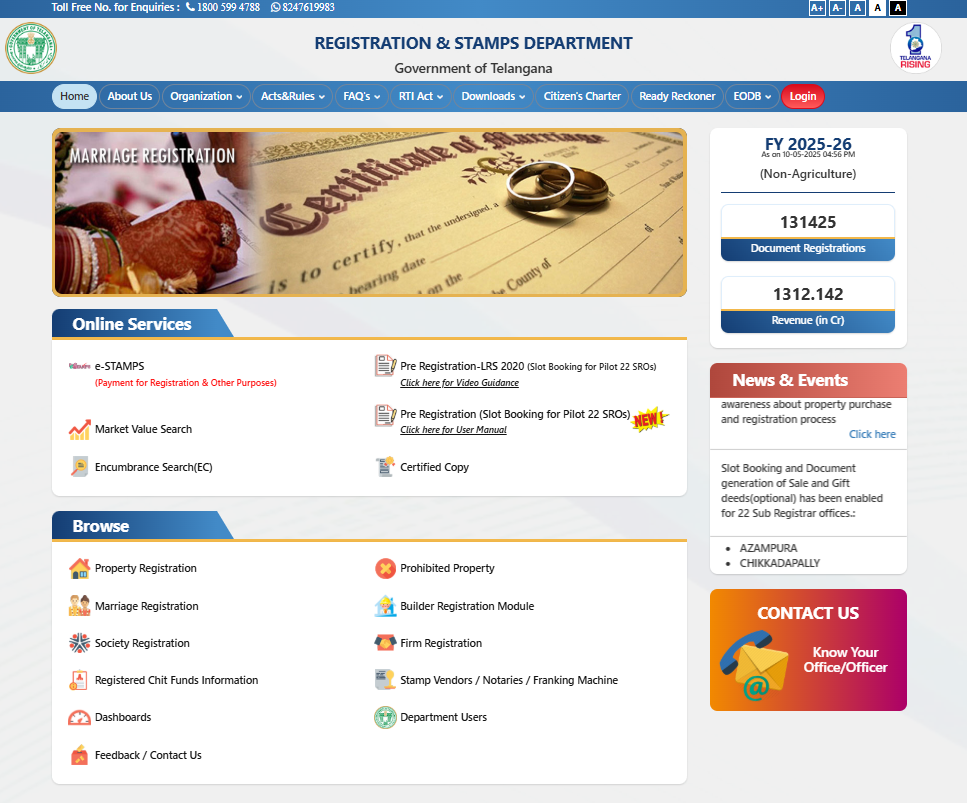
REGISTRATION & STAMPS DEPARTMENT, Govt of Telangana
Click below link for following services:
- e-STAMPS (Payment for Registration & Other Purposes)
- Pre Registration-LRS 2020 (Slot Booking for Pilot 22 SROs)
- Market Value Search
- Pre Registration (Slot Booking for Pilot 22 SROs)
- Encumbrance Search(EC)
- Certified CopyBrowse
- Property Registration
- Prohibited Property
- Marriage Registration
- Builder Registration Module
- Society Registration
- Firm Registration
- Registered Chit Funds Information
- Stamp Vendors / Notaries / Franking Machine
Know your survey number’s location
To find the location of a survey number in Telangana using Google Maps coordinates on the Bhuvan Indian Geo-Platform developed by ISRO, you can follow these steps. This process leverages Bhuvan’s geospatial capabilities, which provide high-resolution satellite imagery and cadastral data. Note that Bhuvan’s data is primarily focused on India and integrates with state-specific land records., such as Telangana’s BhuBharati portal.
Prerequisite:
- Google Maps Coordinates: Obtain the latitude and longitude of the approximate location of your land parcel from Google Maps (e.g., by dropping a pin and noting the coordinates).
- Survey Number: Have the survey number of the land parcel, which is available in ROR-1B or Pahani records.
- Internet Access: A stable connection to access Bhuvan and related portals.
- Device: A computer or smartphone with a web browser (preferably WebGL-enabled for Bhuvan’s 3D features).
Stop-By-Step Process:
- Obtain Google Maps Coordinates:
- Open Google Maps on your device.
- Navigate to the approximate location of your land parcel in Telangana.
- Drop a pin by clicking (on a computer) or long-pressing (on a mobile device) at the location.
- Note the coordinates displayed in the format (latitude, longitude) (e.g., 17.385044, 78.486671 for a location in Hyderabad). You can also right-click (on a computer) and select “What’s here?” to get the coordinates.
- Access Bhuvan Geo-Platform:
- Visit the Bhuvan portal at bhuvan.nrsc.gov.in or use the Bhuvan Lite version at bhuvanlite.nrsc.gov.in for a simpler interface.
- No login is required to visualize maps, but you may need to register if downloading specific datasets (e.g., high-resolution imagery or cadastral data).
- Select the 2D Viewer or 3D Viewer (WebGL-enabled browser recommended for 3D). The 2D Viewer is sufficient for most survey number searches.
- Navigate to Telangana and Input Coordinates:
- In the Bhuvan interface, use the search bar or zoom into Telangana manually.
- To locate the exact spot using Google Maps coordinates:
- Enter the latitude and longitude in the search bar in the format latitude, longitude (e.g., 17.385044, 78.486671).
- Alternatively, use the Draw a Point tool (available under the toolbar) to manually click on the map and input coordinates.
- Bhuvan will zoom to the specified location, displaying satellite imagery or a hybrid view (satellite + map overlay).
- Access Cadastral Data for Survey Number:
- Bhuvan integrates cadastral maps (land parcel boundaries) for several states, including Telangana, through collaborations with state revenue departments.
- Select the Thematic Services or Governance mode from the Bhuvan NextGen Portal (accessible via the homepage).
- Look for the Cadastral Boundary layer or Land Records option. In Telangana, this may link to the Dharani portal or Bhuvan’s own cadastral dataset.
- Enable the cadastral layer to overlay survey number boundaries on the satellite imagery. This layer shows parcel boundaries with survey numbers, especially for rural areas.
- Locate Your Survey Number:
- Zoom into the area identified by the coordinates.
- With the cadastral layer active, survey numbers should be visible on the map. Click on the parcel to view details, which may include the survey number, owner details (if linked to Dharani), and land extent.
- If the survey number is not immediately visible, use the Query Tool or Identify Tool (available in the toolbar) to click on the parcel and retrieve survey number information.
- Cross-reference the survey number with your ROR-1B or Pahani document to confirm accuracy.
- Verify with Dharani Portal (Telangana-Specific):
- Telangana’s Dharani portal (dharani.telangana.gov.in) is integrated with Bhuvan for land records.
- Log in to Dharani using your credentials or visit a MeeSeva center.
- Enter the survey number and select the district, mandal, and village to view the land parcel’s details, including a map overlay.
- Dharani’s map view may also allow you to input coordinates to locate the parcel, which can be cross-checked with Bhuvan’s imagery.
- Additional Tools and Features:
- Measure Distance/Area: Use Bhuvan’s measurement tools to verify the land parcel’s dimensions by drawing a polygon around the boundary.
- Hybrid/Terrain View: Switch between satellite, hybrid, or terrain views to better understand the land’s topography.
- High-Resolution Imagery: Bhuvan offers up to 1-meter resolution for 177 cities and 2.5-meter for rural areas, ensuring precise visualization.
- If the survey number is not found, check for updates in Bhuvan’s dataset or contact the local Tahsildar office for manual verification.
- Troubleshooting:
- Cadastral Data Unavailable: Some areas may lack digitized cadastral maps on Bhuvan. In such cases, use the satellite imagery to visually identify the parcel and verify with Dharani or revenue officials.
- Slow Performance: Bhuvan may be slow due to bandwidth issues. Try Bhuvan Lite or access during off-peak hours.
- Coordinate Mismatch: Ensure coordinates are entered correctly (latitude first, then longitude). Bhuvan uses the WGS84 coordinate system, compatible with Google Maps.
- Survey Number Errors: If the survey number doesn’t match, it could be due to outdated records. Cross-check with ROR-1B/Pahani or consult the Mandal Revenue Office.
Occupancy Certificate (OC) in Telangana
Occupancy Certificate (OC) in Telangana, particularly under the jurisdiction of the Greater Hyderabad Municipal Corporation (GHMC) or Hyderabad Metropolitan Development Authority (HMDA), is essential to ensure a property is legally compliant and safe for occupation. An OC certifies that a building complies with approved plans, safety standards, and local regulations.
Below is a step-by-step guide to verify an Occupancy Certificate in Telangana:
- Gather Property Details:
- Collect key information about the property, including:
- Survey Number.
- Property Address: Including district, mandal, village, or municipal ward.
- Application ID/Number: If the OC application was submitted online.
- Applicant Name.
- Builder/Developer Details: If the OC was obtained by the builder.
- Collect key information about the property, including:
- Check Online via TG-bPASS or GHMC Portal:
- Telangana Building Permission Approval and Self-Certification System (TG-bPASS):
- Visit tgbpass.telangana.gov.in.
- Navigate to Applicant Search or Track Application on the homepage.
- Enter the File Number or Mobile Number associated with the OC application.
- Click Show Status to view the application status, which will indicate if the OC has been approved, rejected, or is under review. Approved OCs can be downloaded as a PDF.
- If the property is linked to a survey number, cross-check with Dharani to ensure the land details match the OC.
- GHMC Website:
- Go to ghmc.gov.in.
- Click on Online Services > Submission of Building Application.
- Log in with your credentials or register as a new user.
- Select the Occupancy Tab and check the status using the DPMS File Number (Development Permission Management System) or property details.
- The portal will display the OC status, and approved certificates can be viewed or downloaded.
- Telangana Building Permission Approval and Self-Certification System (TG-bPASS):
- Verify via Telangana RERA Portal:
- If the property is part of a real estate project registered under the Real Estate Regulatory Authority (RERA):
- Visit the Telangana RERA portal (rera.telangana.gov.in).
- Enter the RERA Project Number or search by project name/developer.
- Check the Uploaded Documents section for the OC, which builders are required to upload for registered projects.
- Cross-reference the survey number from ROR-1B/Pahani to confirm the property’s identity.
- If the property is part of a real estate project registered under the Real Estate Regulatory Authority (RERA):
- Offline Verification at GHMC/HMDA Office:
- Visit the local GHMC office (for properties within Greater Hyderabad) or HMDA office (for areas under HMDA jurisdiction, e.g., Swarna Jayanti Complex, Ameerpet, Hyderabad).
- Carry:
- Property ownership documents (e.g., sale deed, ROR-1B, Pahani).
- Building plan approvals and completion certificate.
- Survey number details for cross-verification.
- Submit a written request for OC verification, including property details and survey number.
- The GHMC/HMDA officials will verify the OC against their records and provide confirmation. This is useful if online records are incomplete or the property is older.
LP Number:
An LP Number, or Layout Plan Number, is a unique identifier assigned by local authorities to a specific layout plan of a real estate development. This number is critical as it establishes that the layout adheres to zoning laws and regulations. Properties with a valid LP Number are considered legally approved and can be developed according to the described specifications. Buyers should always check for an LP Number before proceeding with a property deal, as it reflects the legitimacy of the layout.
Change of Land Use (CLU):
Change of Land Use (CLU) in Telangana refers to the legal process of converting land designated for one purpose (e.g., agricultural) to another purpose (e.g., residential, commercial, or industrial), as per the Telangana Non-Agricultural Lands Assessment (NALA) Act, 1963, and other relevant regulations like the Telangana Municipalities Act, 2019, or Telangana Building Rules, 2012. This process is critical for ensuring land is used in compliance with zoning laws, master plans, and development regulations, particularly in areas under the Greater Hyderabad Municipal Corporation (GHMC), Hyderabad Metropolitan Development Authority (HMDA), or other urban/rural local bodies. It is closely linked to records like ROR-1B and Pahani for verifying land ownership and usage, and it is a prerequisite for obtaining permissions like an Occupancy Certificate (OC) for non-agricultural developments.
Group Housing Permission:
Group Housing Permission in Telangana refers to the approval required from relevant authorities, such as the Greater Hyderabad Municipal Corporation (GHMC), Hyderabad Metropolitan Development Authority (HMDA), or other urban/rural local bodies, to develop a group housing scheme. This involves constructing multiple residential units, such as apartments, villas, or gated communities, on a single plot of land, typically for collective residential use. The permission ensures compliance with zoning regulations, building norms, and land use policies, as outlined in the Telangana Building Rules, 2012, Telangana Municipalities Act, 2019, and the Master Plan of the respective area. It is closely linked to processes like Change of Land Use (CLU) under the Non-Agricultural Lands Assessment (NALA) Act, ROR-1B and Pahani